SOUTHERN + EASTERN BOUNDARIES — builder's setting-out sheet · registered General Plan GP 12794 (L.G. 9249/89) · prepared 2026-07-22
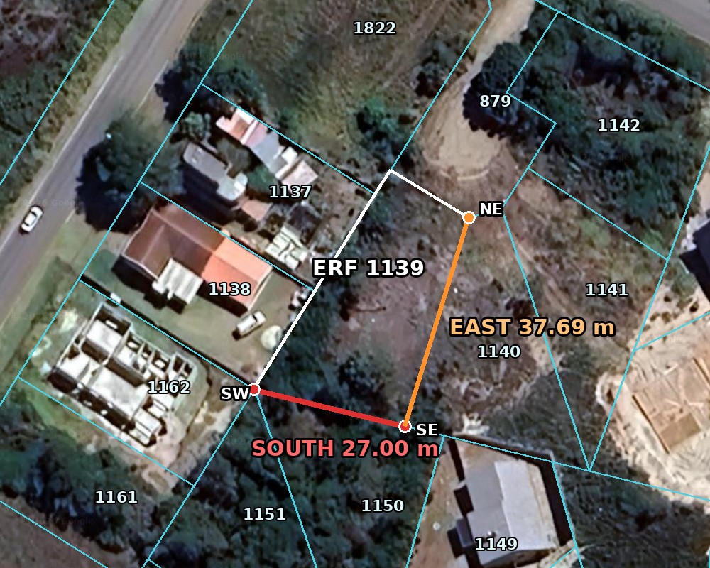
SOUTH · 27.00 m
Straight line, SW peg → SE peg, along the rear boundaries of Erf 1150 & Erf 1151 (Swemmer St properties). Direction ≈ 103.6° true (SW→SE). Erf 1139 lies on the north side of the line.
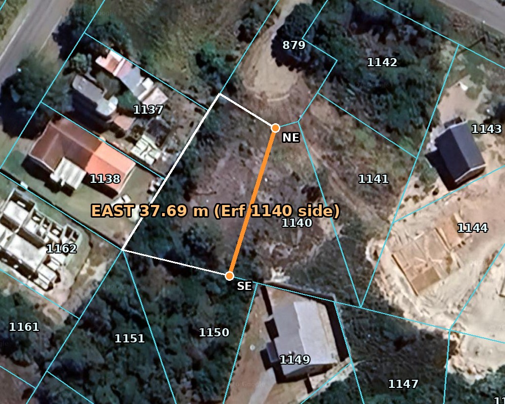
EAST · 37.69 m
Straight line, SE peg → NE peg, along the boundary with Erf 1140 (8 Koraal Ave). Direction ≈ 17.2° true (SE→NE) / 197.2° (NE→SE). Erf 1139 lies on the west side of the line. The NE peg is also the eastern end of the 16.00 m street front.
1 · The three pegs that define both lines
SW peg (south line meets the 45.00 m west line) -34.096665, 24.892432 34°05'48.0"S 24°53'32.8"E
SE peg (common corner — south line meets east line) -34.096722, 24.892717 34°05'48.2"S 24°53'33.8"E
NE peg (east line meets the 16.00 m street front) -34.096396, 24.892839 34°05'47.0"S 24°53'34.2"E
⚠ GPS coordinates are digitised from the SG cadastre (±0.3 m) — good enough to find the pegs, NOT to place a wall. The registered tape distances are authoritative. If a peg is missing or disturbed, a registered land surveyor must replace it (contact brief already prepared).
2 · Plan (south red · east orange)
2b · Aerial views (Kouga / SG cadastre on satellite)
Zoomed — both working boundaries (white = registered erf outline, red = 27.00 m south line, orange = 37.69 m east line, cyan = neighbouring cadastre) tap image for full resolution
East boundary in detail (SE → NE along Erf 1140) tap image for full resolution
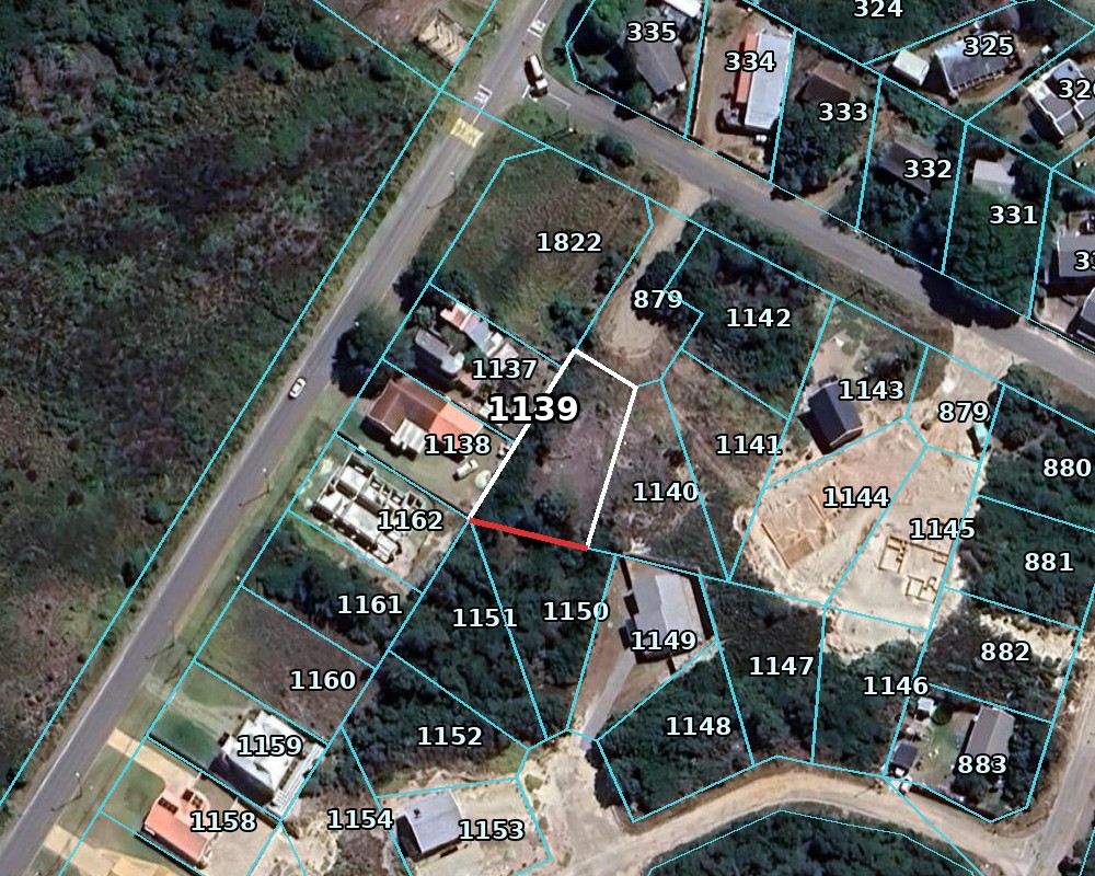
Cadastre — the whole surrounding block with erf numbers (cyan = SG cadastre boundaries; 1137 is our office, 1150/1151 are the neighbours behind the south line, 1140 borders the east line) tap image for full resolution
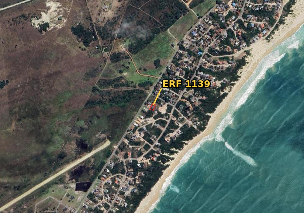
Context — where the stand sits in Paradise Beach tap image for full resolution
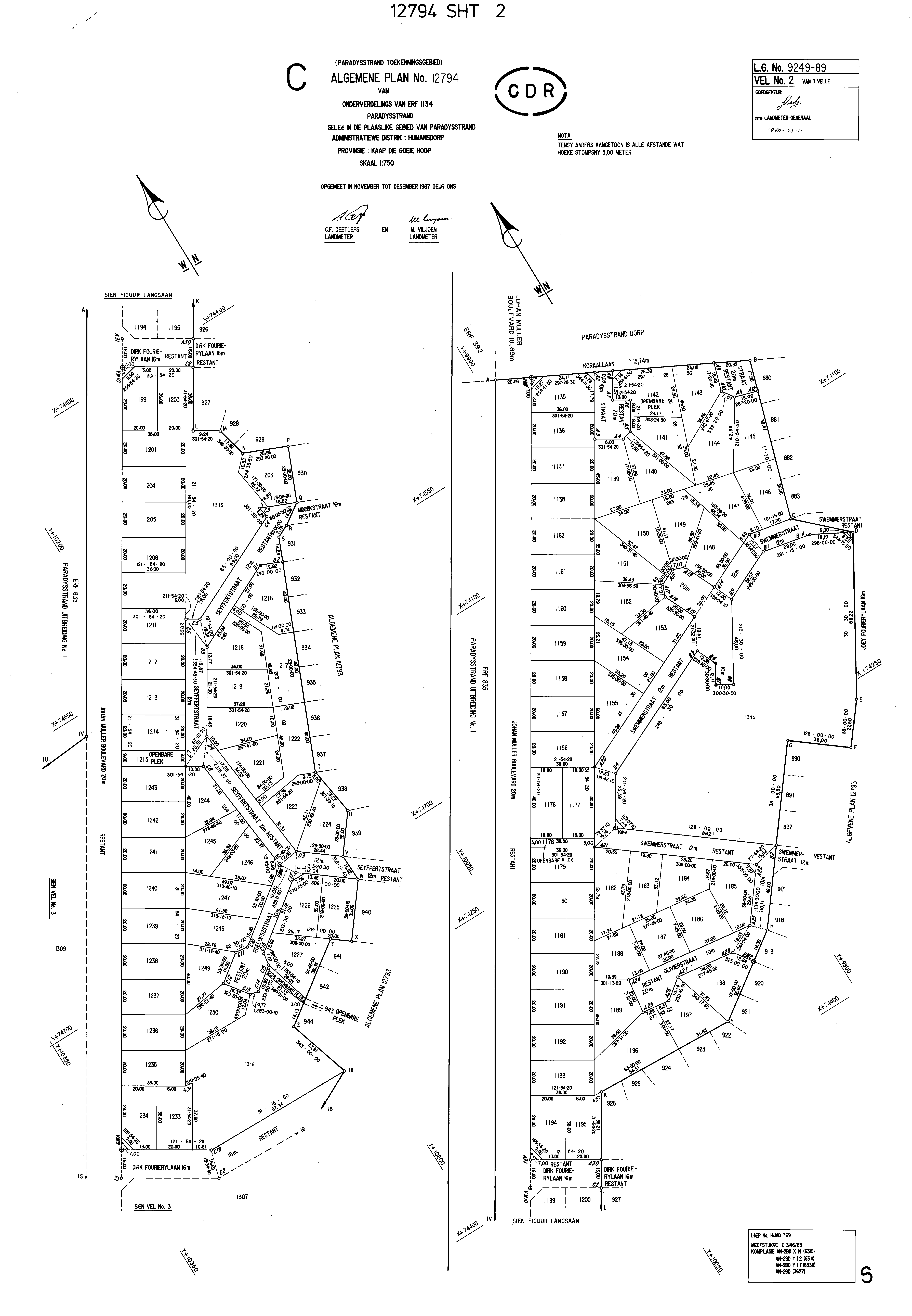
2c · The registered General Plan — GP 12794 (L.G. 9249/89)
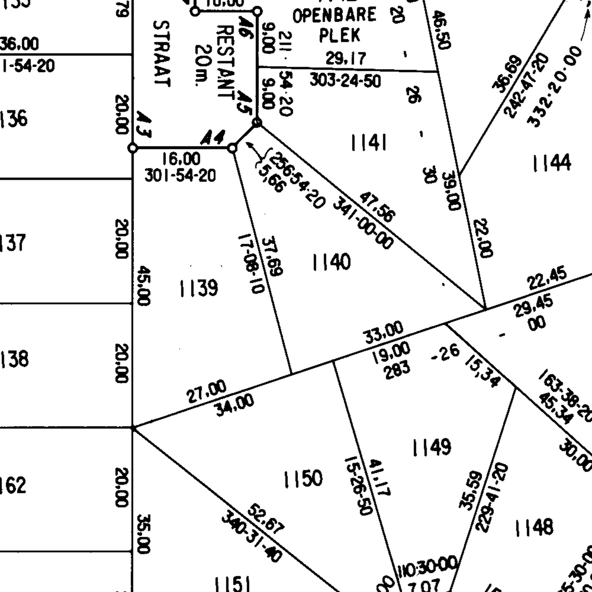
This is the LEGAL source of the boundary figures — subdivision of Erf 1134 Paradysstrand, surveyed Nov–Dec 1987, approved 1990-05-11. The zoom shows Erf 1139 with the registered distances AND bearings (east line 17°08'10", street 301°54'20") and the beacon labels (A3–A6 at the street).
GP zoomed to the property — Erf 1139 block with registered distances/bearings tap image for full resolution
Measure from any peg you can find — the intersection of two tape arcs locates the next peg. Registered figures in bold; others are cadastre-derived checks (±0.3 m).
From
To
Tape distance
Note
SW peg
SE peg
27.00 m
the southern boundary itself — wire check
SE peg
NE peg
37.69 m
the eastern boundary itself — wire check
NE peg
Street-WEST corner peg
16.00 m
along the street front (Koraal cul-de-sac)
SW peg
top of west line (5 m jog pt)
39.93 m
along the 45.00 m registered west line (SW peg is its south end)
SW peg
Street-WEST corner peg
44.91 m
diagonal check
SW peg
NE peg
47.88 m
the long diagonal — checks all three pegs at once
SE peg
Street-WEST corner peg
44.40 m
diagonal check
4 · Guide wire & chainage — both lines
Locate the pegs (usually 12 mm iron pegs, may be buried — probe/dig at the coordinates above; use GPS mode below to get within a metre or two).
South line: stretch a guide wire SW → SE. Taped length must read 27.00 m.
East line: stretch a guide wire SE → NE. Taped length must read 37.69 m.
If either wire doesn't tape to the registered figure, stop and query the pegs before building.
Any boundary point = a distance along the wire ("chainage"). Calculators:
South line — chainage from SW peg: m
East line — chainage from SE peg: m
Chainage tables (every 3 m — for printing)
SOUTH line (from SW peg)
Chainage (m)
Latitude
Longitude
EAST line (from SE peg)
Chainage (m)
Latitude
Longitude
5 · Live GPS mode (open this page on a phone, on site)
GPS off.
Phone GPS is ±3–8 m — use it to walk to the right spot and find the pegs, then switch to wire + tape. Never build off phone GPS.
 tap image for full resolution
 tap image for full resolution
 tap image for full resolution
 tap image for full resolution
 tap image for full resolution
 tap image for full resolution · also: sheet 1 (beacon coordinate lists & areas) · sheet 3